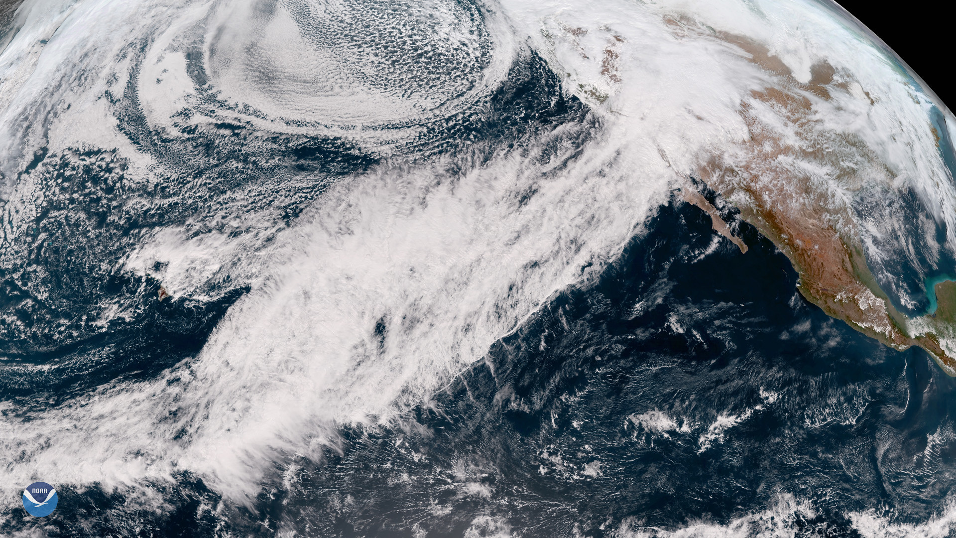
Since late December, atmospheric rivers — so-called “rivers in the sky” capable of dropping staggering amounts of precipitation — have wreaked havoc up and down California, causing power outages, flooding, washouts and landslides nearly statewide.
Where an atmospheric river lands and how intense it will be is something researchers are trying to better forecast by flying data-collecting missions into the storms — and Portland State grad student Emma Russell gets to be a part of the action.

“It’s been a really great time for me to be involved because it has been so active these last couple of weeks,” said Russell, who’s in her first year of the geography master’s program after graduating with her bachelor’s in physics this past June. She’s a member of PSU’s Climate Science Lab, which is involved in the project’s research arm.
The Atmospheric Reconnaissance program (AR Recon), led by the Center for Western Weather and Water Extremes at the Scripps Institution of Oceanography in San Diego, has aircraft on standby when atmospheric rivers approach the West Coast. Instruments measuring 16 inches long and less than three inches in diameter are dropped by parachute. During their 20-minute journey to the ocean surface, they transmit data back to the aircraft about temperature, pressure, water vapor and winds. The data then helps improve weather forecasts and related long-term research.
For the better part of the last month, whenever there’s been an active atmospheric river over the Pacific, Russell has been on early-morning calls, helping prepare forecast briefs for the larger AR Recon team.
“We look at a few meteorological variables over the North Pacific and then we focus on the impacts that are predicted as well,” she said. “We’ll see what the rivers are looking like in parts of California that are being impacted by these atmospheric rivers and if they’re predicted to reach a flood level or not. … We’ll also go back the following day to see if those forecasts were accurate as far as impacts go.”
Russell’s involvement in AR Recon stems from a subgrant that the Climate Science Lab received related to Forecast-Informed Reservoir Operations (FIRO), a multi-agency effort aimed at better managing water levels in California reservoirs. As California alternates between extremes of drought and flood, accurate forecasts are increasingly vital to water managers and can help them decide whether to retain water if no additional storms are forecast or release it to mitigate the flooding risk.
Russell’s main focus has been researching the 2020 Labor Day wildfires and the dry weather that caused such extreme conditions, so she’s been enjoying exploring the other, much wetter, side of extreme precipitation.
“I’ve just been hopping on and learning as much as I can and helping out where I can,” she said.
Featured Image: File NOAA satellite image of an atmospheric river drenching California.